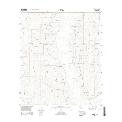
2015 Map of Liverpool
USGS Topo · Published 2015About this map
The Tickfaw River and its numerous tributaries, including Cotton Patch Br and Crittenden Cr, define the drainage and settlement patterns of this section of St. Helena Parish. Centered on the communities of Liverpool and Easleyville, the landscape is a network of rural routes such as La-1043 and Parish Road 165. The area is notably dense with family and community burial grounds, reflecting the deep genealogical roots of the region through sites like Old Venable Cem, Carruth Cem, and Jackson Cem. Local worship is centered at Venable Chapel, while the presence of Spring Airport indicates the modern infrastructure serving this timber and agricultural corridor. The map details a transition where smaller runs like S Sandy Run and Joseph Br feed into the larger river systems that move south toward the gulf lowlands.
Find a feature on this map
110 named features on this map. Tap any name to fly to it.
Don’t see what you’re looking for? This feature index may not catch every label — zoom into the map to look around manually.
Map Details
Editions of this 2015 Liverpool Map
This is the sole edition of this map. No revisions or reprints were ever made.
Other maps of this area

1940 · Roseland
USGS Topo · 1:31,680

1941 · Gilead
USGS Topo · 1:31,680

1941 · Chipola
USGS Topo · 1:31,680

1942 · Roseland
USGS Topo · 1:31,680

1942 · Liverpool
USGS Topo · 1:31,680

1942 · Gilead
USGS Topo · 1:31,680

1945 · Chipola
USGS Topo · 1:31,680

1950 · Kentwood
USGS Topo · 1:31,680

1950 · Greensburg
USGS Topo · 1:31,680

1953 · Natchez
USGS Topo · 1:250,000