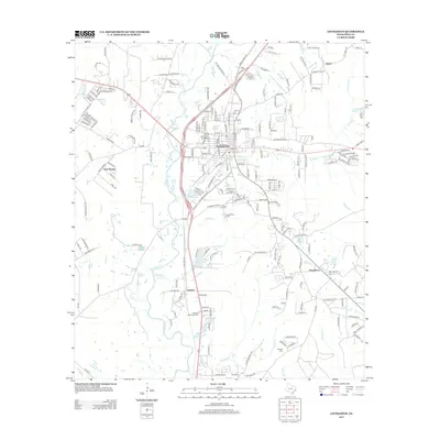
2013 Map of Livingston
USGS Topo · Published 2013About this map
Livingston serves as the focal point of this East Texas survey, showcasing a dense network of streets and local landmarks including Camp Cho-Yeh and several community burial grounds. The landscape is defined by the convergence of multiple waterways, with Choates Creek winding through the heart of the settlement while Long King Creek and Tempe Creek drain the surrounding timberlands.
Find a feature on this map
54 named features on this map. Tap any name to fly to it.
Don’t see what you’re looking for? This feature index may not catch every label — zoom into the map to look around manually.
Map Details
Editions of this 2013 Livingston Map
This is the sole edition of this map. No revisions or reprints were ever made.
Other maps of this area

1954 · Beaumont
USGS Topo · 1:250,000

1955 · New Willard
USGS Topo · 1:62,500

1957 · Beaumont
USGS Topo · 1:250,000

1958 · Livingston
USGS Topo · 1:62,500

1960 · Blanchard
USGS Topo · 1:24,000

1960 · Camilla
USGS Topo · 1:24,000

1961 · Onalaska
USGS Topo · 1:24,000

1984 · Soda
USGS Topo · 1:24,000

1984 · Beaumont
USGS Topo · 1:250,000
1984 · Livingston
USGS Topo · 1:24,000