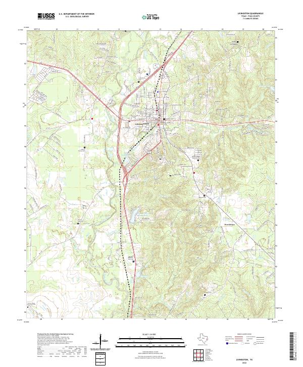
2022 Map of Livingston
USGS Topo · Published 2022About this map
Livingston serves as the focal point of this East Texas survey, anchored by the Polk County Courthouse and the nearby Polk County Judicial Center. The landscape is defined by the winding course of Long-King Creek and Choates Cr, which feed into local water bodies such as Lake Thunderbird and Lake Jobe. The mapping reveals a high density of burial sites that speak to the area's deep family roots, ranging from the central Old City Cem to smaller, outlying plots like the Moore Family Cem and the Victory Place Beautiful Cem.
Find a feature on this map
163 named features on this map. Tap any name to fly to it.
Don’t see what you’re looking for? This feature index may not catch every label — zoom into the map to look around manually.
Map Details
Editions of this 2022 Livingston Map
This is the sole edition of this map. No revisions or reprints were ever made.
Other maps of this area

1954 · Beaumont
USGS Topo · 1:250,000

1955 · New Willard
USGS Topo · 1:62,500

1957 · Beaumont
USGS Topo · 1:250,000

1958 · Livingston
USGS Topo · 1:62,500

1960 · Blanchard
USGS Topo · 1:24,000

1960 · Camilla
USGS Topo · 1:24,000

1961 · Onalaska
USGS Topo · 1:24,000

1984 · Soda
USGS Topo · 1:24,000

1984 · Beaumont
USGS Topo · 1:250,000
1984 · Livingston
USGS Topo · 1:24,000