
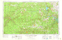
1954 Map of Llano
USGS Topo · Published 1964About this map
The Colorado River system dominates this mid-century portrait of the Texas Hill Country, featuring the significant impoundments of Buchanan Lake, Granite Shoals Lake, and the western reaches of Lake Travis. This era captures the region as its hydraulic character was being permanently reshaped by the Highland Lakes project, contrasting with the ancient meandering paths of the Llano River and San Saba River to the west.
Find a feature on this map
37 named features on this map. Tap any name to fly to it.
Don’t see what you’re looking for? This feature index may not catch every label — zoom into the map to look around manually.
Map Details
Editions of this 1954 Llano Map
2 editions found
Other maps of this area

1885 · San Saba
USGS Topo · 1:125,000

1887 · Llano
USGS Topo · 1:125,000

1887 · Lampasas
USGS Topo · 1:125,000

1887 · Blanco
USGS Topo · 1:125,000

1887 · Mason
USGS Topo · 1:125,000

1887 · Burnet
USGS Topo · 1:125,000

1892 · San Angelo
USGS Topo · 1:125,000

1892 · Eden
USGS Topo · 1:125,000

1893 · Rock Springs
USGS Topo · 1:125,000

1893 · Fort McKavett
USGS Topo · 1:125,000