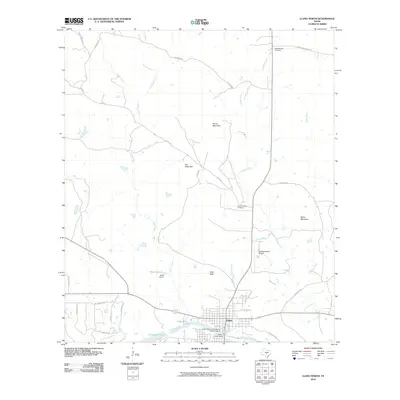
2010 Map of Llano North
USGS Topo · Published 2010About this map
The Llano County Courthouse Historic District anchors this northern survey of the Texas Hill Country, where the city of Llano sits along the banks of the Llano River. The landscape is defined by its water management and distinct granite uplands, including Fox Mountain, Horse Mountain, and Miller Mountain. Local industry and infrastructure are evident in the presence of Moss Dam 2 and the Llano River Dam, which create reservoirs like Moss Lake 2 and Llano River Lake.
Find a feature on this map
38 named features on this map. Tap any name to fly to it.
Don’t see what you’re looking for? This feature index may not catch every label — zoom into the map to look around manually.
Map Details
Editions of this 2010 Llano North Map
This is the sole edition of this map. No revisions or reprints were ever made.
Other maps of this area

1887 · Llano
USGS Topo · 1:125,000

1894 · Llano
USGS Topo · 1:125,000

1904 · Llano
USGS Topo · 1:125,000

1909 · Llano
USGS Topo · 1:125,000

1918 · Llano
USGS Topo · 1:125,000

1954 · Llano
USGS Topo · 1:250,000

1955 · Llano
USGS Topo · 1:250,000
1955 · Magill Mountain
USGS Topo · 1:24,000

1955 · Valley Spring
USGS Topo · 1:24,000
1955 · Llano North
USGS Topo · 1:24,000