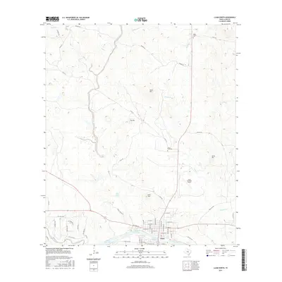
2016 Map of Llano North
USGS Topo · Published 2016About this map
The Llano River and its several impoundments, including Llano City Lake and Llano River Lake, anchor the southern edge of this Hill Country landscape. The city of Llano occupies the riverbanks, featuring a dense residential grid with streets like W Main St and W Dallas St radiating from the central core. To the north, the terrain transitions into a series of prominent rises such as Town Peak, Horse Mtn, and Fox Mtn, which overlook a network of seasonal drainages including Wrights Cr and Babyhead Creek.
Find a feature on this map
58 named features on this map. Tap any name to fly to it.
Don’t see what you’re looking for? This feature index may not catch every label — zoom into the map to look around manually.
Map Details
Editions of this 2016 Llano North Map
This is the sole edition of this map. No revisions or reprints were ever made.
Other maps of this area

1887 · Llano
USGS Topo · 1:125,000

1894 · Llano
USGS Topo · 1:125,000

1904 · Llano
USGS Topo · 1:125,000

1909 · Llano
USGS Topo · 1:125,000

1918 · Llano
USGS Topo · 1:125,000

1954 · Llano
USGS Topo · 1:250,000

1955 · Llano
USGS Topo · 1:250,000
1955 · Magill Mountain
USGS Topo · 1:24,000

1955 · Valley Spring
USGS Topo · 1:24,000
1955 · Llano North
USGS Topo · 1:24,000