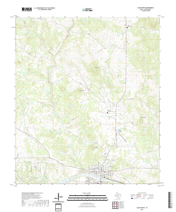
2022 Map of Llano North
USGS Topo · Published 2022About this map
Llano sits at the southern edge of this landscape, its street grid reaching toward the banks of the Llano River. To the north, the terrain transitions into a series of distinct rises and drainages, including Horse Mtn, Fox Mtn, and Town Peak. Water sources such as Pecan Creek, Babyhead Creek, and the artificial Moss Lake 2 provide structure to the rural surroundings. Genealogical interest is centered on the northern reaches of the quadrangle at Mayes Chapel Cem and further south near Wrights Creek Cem. The transition from the urban environment of Llano to the surrounding hills is marked by the presence of the Llano Municipal Airport, while the northern portion of the map remains defined by ranch roads and named peaks that characterize the local geography.
Find a feature on this map
65 named features on this map. Tap any name to fly to it.
Don’t see what you’re looking for? This feature index may not catch every label — zoom into the map to look around manually.
Map Details
Editions of this 2022 Llano North Map
This is the sole edition of this map. No revisions or reprints were ever made.
Other maps of this area

1887 · Llano
USGS Topo · 1:125,000

1894 · Llano
USGS Topo · 1:125,000

1904 · Llano
USGS Topo · 1:125,000

1909 · Llano
USGS Topo · 1:125,000

1918 · Llano
USGS Topo · 1:125,000

1954 · Llano
USGS Topo · 1:250,000

1955 · Llano
USGS Topo · 1:250,000
1955 · Magill Mountain
USGS Topo · 1:24,000

1955 · Valley Spring
USGS Topo · 1:24,000
1955 · Llano North
USGS Topo · 1:24,000