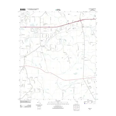
2012 Map of Lloyd
USGS Topo · Published 2012About this map
The Saint Marks River and its network of tributaries, including Gum Cr and Burnt Mill Cr, define the drainage of this north Florida landscape. This 2012 survey illustrates the distinct karst topography of the region, where numerous depressions like Gray Sink, Copeland Sink, and Bird Sink signal the area's complex subterranean hydrology. The rural settlements of Lloyd, Capitola, and Chaires are connected by a mix of established roads such as Lafitte Rd and St Augustine, while smaller family-named landmarks like Broomsage Cem and Jones Cem offer valuable points of reference for local genealogical research. Small aviation facilities, including Angel's Field Airport and Charlotte's Field Airport, serve the local community. The eastern edge features notable water bodies like The Cascade and Story Lake, contributing to the area's ecological character before the waters reach the southern river systems.
Find a feature on this map
146 named features on this map. Tap any name to fly to it.
Don’t see what you’re looking for? This feature index may not catch every label — zoom into the map to look around manually.
Map Details
Editions of this 2012 Lloyd Map
This is the sole edition of this map. No revisions or reprints were ever made.
Other maps of this area

1954 · Lloyd
USGS Topo · 1:24,000

1954 · Lafayette
USGS Topo · 1:24,000

1954 · Cody
USGS Topo · 1:24,000

1954 · Woodville
USGS Topo · 1:24,000

1954 · Valdosta
USGS Topo · 1:250,000

1954 · Tallahassee
USGS Topo · 1:250,000

1955 · Waukeenah
USGS Topo · 1:24,000

1955 · Wacissa
USGS Topo · 1:24,000

1958 · Valdosta
USGS Topo · 1:250,000

1959 · Tallahassee
USGS Topo · 1:250,000