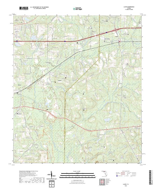
2024 Map of Lloyd
USGS Topo · Published 2024About this map
Lloyd and its surrounding communities in Leon and Jefferson counties are defined by a complex karst landscape of sinks and seasonal ponds. The area's agricultural and social history is visible through numerous family and church burial grounds, such as the Robinson Family Cem and the El Destino Plantation Cem. Natural drainage features are abundant, including the Saint Marks River and various geological depressions like Wood Sink, Patty Sink, and Bird Sink. These features illustrate the subterranean hydrology that shapes the region's surface. Conservation efforts are represented by the Saint Marks River Preserve State Park, while the local settlements of Capitola and Chaires maintain their distinct geographic identities. The map also records several African Methodist Episcopal landmarks, including the Mount Zion A M E Church and Saint Paul A M E Church, which serve as vital points for genealogical research and community heritage.
Find a feature on this map
162 named features on this map. Tap any name to fly to it.
Don’t see what you’re looking for? This feature index may not catch every label — zoom into the map to look around manually.
Map Details
Editions of this 2024 Lloyd Map
This is the sole edition of this map. No revisions or reprints were ever made.
Other maps of this area

1954 · Lloyd
USGS Topo · 1:24,000

1954 · Lafayette
USGS Topo · 1:24,000

1954 · Cody
USGS Topo · 1:24,000

1954 · Woodville
USGS Topo · 1:24,000

1954 · Valdosta
USGS Topo · 1:250,000

1954 · Tallahassee
USGS Topo · 1:250,000

1955 · Waukeenah
USGS Topo · 1:24,000

1955 · Wacissa
USGS Topo · 1:24,000

1958 · Valdosta
USGS Topo · 1:250,000

1959 · Tallahassee
USGS Topo · 1:250,000