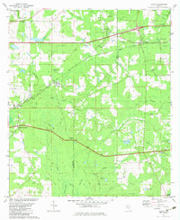
1982 Map of Lloyd
USGS Topo · Published 1983About this map
Lloyd and its surrounding rural landscapes are defined by a complex network of wetlands and karst topography along the border of Leon and Jefferson counties. This 1982 map reveals a terrain pockmarked by geological depressions such as Patty Sink, Copeland Sink, and Bird Sink, which interact with the headwaters of the St Marks River and the Wacissa River. Small community centers like Capitola and Chaires are connected by the Seaboard Coast Line railroad and the Old Railroad Grade, reflecting the area's transit and timber history.
Find a feature on this map
55 named features on this map. Tap any name to fly to it.
Don’t see what you’re looking for? This feature index may not catch every label — zoom into the map to look around manually.
Map Details
Editions of this 1982 Lloyd Map
This is the sole edition of this map. No revisions or reprints were ever made.
Other maps of this area

1954 · Lloyd
USGS Topo · 1:24,000

1954 · Lafayette
USGS Topo · 1:24,000

1954 · Cody
USGS Topo · 1:24,000

1954 · Woodville
USGS Topo · 1:24,000

1954 · Valdosta
USGS Topo · 1:250,000

1954 · Tallahassee
USGS Topo · 1:250,000

1955 · Waukeenah
USGS Topo · 1:24,000

1955 · Wacissa
USGS Topo · 1:24,000

1958 · Valdosta
USGS Topo · 1:250,000

1959 · Tallahassee
USGS Topo · 1:250,000