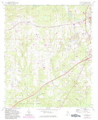
1971 Map of Loachapoka
USGS Topo · Published 1984About this map
Loachapoka serves as a primary hub for this Lee County region, centered around the Seaboard Coast Line railroad and its associated tracks. The settlement is well-documented with the Loachapoka Cem and the Loachapoka Jr High Sch providing clear markers for family researchers. South of the town, the landscape transitions into the northern reaches of the Tuskegee National Forest, where smaller settlements like Beehive appear alongside a network of country churches including Armstrong Ch and Crazier Ch. The map illustrates a balance between traditional agriculture and growing infrastructure, as evidenced by the numerous Gravel Pits and the proximity to the western edge of Auburn. Waterways such as Sougahatchee Cr and Choctafanta Creek carve through the terrain, defining the rural character of the area during the early 1970s.
Find a feature on this map
31 named features on this map. Tap any name to fly to it.
Don’t see what you’re looking for? This feature index may not catch every label — zoom into the map to look around manually.
Map Details
Editions of this 1971 Loachapoka Map
3 editions found
Other maps of this area

1906 · Dadeville
USGS Topo · 1:125,000

1907 · Opelika
USGS Topo · 1:125,000

1909 · Opelika
USGS Topo · 1:125,000

1955 · Phenix City
USGS Topo · 1:250,000

1957 · Phenix City
USGS Topo · 1:250,000

1958 · Phenix City
USGS Topo · 1:250,000

1971 · Waverly
USGS Topo · 1:24,000

1971 · Little Texas
USGS Topo · 1:24,000
1971 · Opelika West
USGS Topo · 1:24,000

1971 · Loachapoka
USGS Topo · 1:24,000