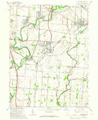
1964 Map of Lockbourne
USGS Topo · Published 1966About this map
Lockbourne Air Force Base dominates the central landscape of this mid-1960s survey, illustrating the significant military footprint in southern Franklin County during the Cold War era. The surrounding territory reveals a transition from traditional agricultural life to post-war suburbanization, evidenced by the development of Hamilton Meadows and the expansion of Obetz and Groveport. The convergence of Alum Creek, Big Walnut Creek, and Walnut Creek underscores the importance of the river valleys for both transport and industry, with several Gravel Pits and a Sandpit active along the water's edge.
Find a feature on this map
58 named features on this map. Tap any name to fly to it.
Don’t see what you’re looking for? This feature index may not catch every label — zoom into the map to look around manually.
Map Details
Editions of this 1964 Lockbourne Map
3 editions found
Other maps of this area

1911 · Era
USGS Topo · 1:62,500

1913 · Era
USGS Topo · 1:62,500

1914 · Circleville
USGS Topo · 1:62,500

1923 · West Columbus
USGS Topo · 1:62,500

1925 · East Columbus
USGS Topo · 1:62,500

1925 · West Columbus
USGS Topo · 1:62,500

1943 · Era
USGS Topo · 1:62,500

1943 · Circleville
USGS Topo · 1:62,500

1943 · East Columbus
USGS Topo · 1:62,500

1947 · Columbus
USGS Topo · 1:250,000