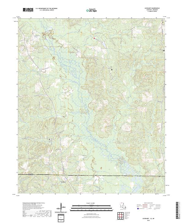
2024 Map of Lockhart
USGS Topo · Published 2024About this map
Bayou de Loutre meanders through the heart of this borderland landscape, where the northern edge of Louisiana's Union Parish meets Union County, Arkansas. The terrain is defined by a dense network of tributaries including Hibank Creek, Mill Creek, and Tenmile Creek, which carve through the timberlands. The settlement of Lockhart sits near the state line, serving as a focal point for a rural community connected by family-named routes like Iron Mountain Rd and Frank Vickers Rd.
Find a feature on this map
60 named features on this map. Tap any name to fly to it.
Don’t see what you’re looking for? This feature index may not catch every label — zoom into the map to look around manually.
Map Details
Editions of this 2024 Lockhart Map
This is the sole edition of this map. No revisions or reprints were ever made.
Other maps of this area

1927 · El Dorado
USGS Topo · 1:62,500

1930 · El Dorado
USGS Topo · 1:62,500

1933 · Strong
USGS Topo · 1:62,500

1937 · Strong
USGS Topo · 1:62,500

1939 · Strong
USGS Topo · 1:62,500

1951 · Bernice
USGS Topo · 1:62,500

1951 · El Dorado
USGS Topo · 1:62,500

1952 · Farmerville
USGS Topo · 1:62,500

1953 · El Dorado
USGS Topo · 1:250,000

1955 · Shreveport
USGS Topo · 1:250,000