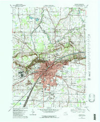
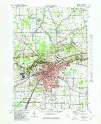
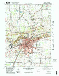
1980 Map of Lockport
USGS Topo · Published 1980About this map
Erie Canal engineering and the sharp escarpment topography dominate this landscape as it appeared in the early 1980s. The city of Lockport is the focal point, showing a dense network of streets and industrial sites like the Filtration Plant and various Quarry operations. To the north, the terrain drops significantly into The Gulf and along the winding path of Eighteenmile Creek, where the transition from urban center to fruit-growing country is evident.
Find a feature on this map
132 named features on this map. Tap any name to fly to it.
Don’t see what you’re looking for? This feature index may not catch every label — zoom into the map to look around manually.
Map Details
Editions of this 1980 Lockport Map
3 editions found
Other maps of this area
1894 · Wilson
USGS Topo · 1:62,500

1897 · Tonawanda
USGS Topo · 1:62,500
1897 · Olcott
USGS Topo · 1:62,500

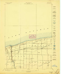
1897 · Lockport
USGS Topo · 1:62,500

1899 · Niagara
USGS Topo · 1:125,000
1900 · Wilson
USGS Topo · 1:62,500

1900 · Tonawanda
USGS Topo · 1:62,500

1901 · Tonawanda
USGS Topo · 1:62,500

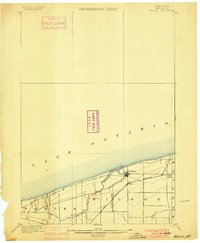
1902 · Lockport
USGS Topo · 1:62,500

1905 · Lockport
USGS Topo · 1:62,500