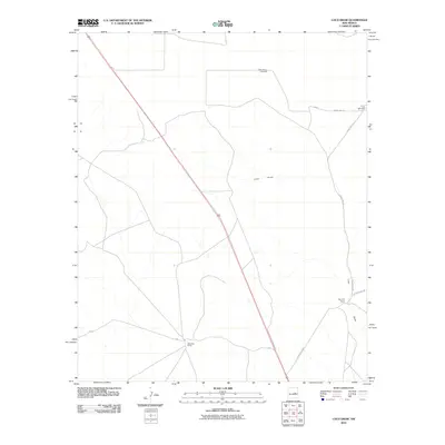
2010 Map of Loco Draw
USGS Topo · Published 2010About this map
Mile High Ranch and Reynolds Ranch anchor this corner of Lincoln County, New Mexico, where the high desert terrain is defined by wide-open rangeland and the essential water infrastructure of a working landscape. The ephemeral drainage of Loco Draw meanders across the territory, tracing a path through a region where life and livelihood depend on scattered groundwater sources. These are marked by functional landmarks such as West Pature Windmill and the distinctive Twin Windmills in the northeast. The map illustrates a network of rural transit, including County Rd-1-55 and County Rd-1-53, which connect these remote ranching outposts. This 2010 survey by the U.S. Geological Survey captures the enduring character of the New Mexico interior, documenting the specific fencing, roads, and water points that define local property and history.
Find a feature on this map
9 named features on this map. Tap any name to fly to it.
Don’t see what you’re looking for? This feature index may not catch every label — zoom into the map to look around manually.
Map Details
Editions of this 2010 Loco Draw Map
This is the sole edition of this map. No revisions or reprints were ever made.
Other maps of this area

1954 · Fort Sumner
USGS Topo · 1:250,000

1958 · Fort Sumner
USGS Topo · 1:250,000

1967 · Ramon
USGS Topo · 1:24,000

1967 · Wright Ranch
USGS Topo · 1:24,000

1979 · Fort Sumner
USGS Topo · 1:100,000

1980 · Corona
USGS Topo · 1:100,000

1981 · Loco Draw
USGS Topo · 1:24,000

1981 · Cowboy Mesa NE
USGS Topo · 1:24,000

1981 · Gacho Hill SE
USGS Topo · 1:24,000

1981 · Yeso Mesa
USGS Topo · 1:24,000