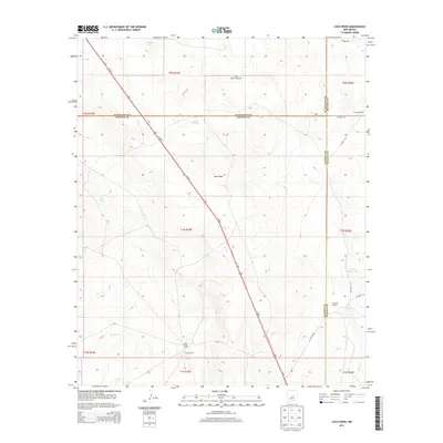
2013 Map of Loco Draw
USGS Topo · Published 2013About this map
Loco Draw defines the central topography of this high-desert landscape where Lincoln, Guadalupe, and De Baca counties meet. This 2013 survey documents a remote rangeland punctuated by isolated homesteads and essential water infrastructure. Notable cattle operations like the Mille-High Ranch, Aston Ranch, and Reynolds Ranch anchor the southern portion of the sheet. The scarcity of natural surface water is evident in the prevalence of man-made features such as Little N Tank, Meadow Pasture Tanks, and Fain Tank, which are critical for supporting livestock in this arid environment. Transportation through this expanse is dominated by the diagonal corridor of Us-285, cutting across the terrain toward the northwest corner near Barrel Lake. Traditional ranching resources remain vital to the local economy, illustrated by landmarks like the West Pasture Windmill and Twin Windmills, which stand as functional markers in the wide-open landscape.
Find a feature on this map
28 named features on this map. Tap any name to fly to it.
Don’t see what you’re looking for? This feature index may not catch every label — zoom into the map to look around manually.
Map Details
Editions of this 2013 Loco Draw Map
This is the sole edition of this map. No revisions or reprints were ever made.
Other maps of this area

1954 · Fort Sumner
USGS Topo · 1:250,000

1958 · Fort Sumner
USGS Topo · 1:250,000

1967 · Ramon
USGS Topo · 1:24,000

1967 · Wright Ranch
USGS Topo · 1:24,000

1979 · Fort Sumner
USGS Topo · 1:100,000

1980 · Corona
USGS Topo · 1:100,000

1981 · Loco Draw
USGS Topo · 1:24,000

1981 · Cowboy Mesa NE
USGS Topo · 1:24,000

1981 · Gacho Hill SE
USGS Topo · 1:24,000

1981 · Yeso Mesa
USGS Topo · 1:24,000