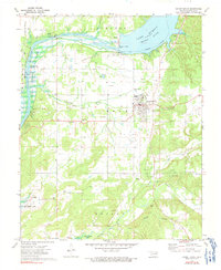
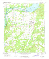
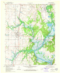
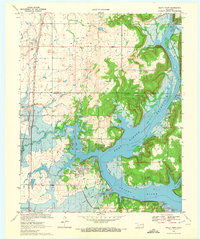
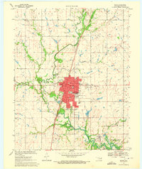
1972 Map of Locust Grove
USGS Topo · Published 1991About this map
Locust Grove serves as the primary hub of this eastern Oklahoma landscape, positioned just south of the massive Lake Hudson Neosho River and the Robert S Kerr Dam. The 1972 topography reflects a region shaped by both water management and industry, with the Mid-America Industrial District bordering the Neosho River in the northwest. Local family history and early community ties are well-preserved through numerous rural landmarks such as Hogan Cem, New Hogan Ch, and McLain Cem. The presence of several stretches of Old Railroad Grade and Old RR Grade indicates the remnants of former rail corridors that once supported the local economy. From the high ground of the Choteau Plateau to the southern reaches near Murphy and Fort Gibson Lake, the map provides a look at the intersection of traditional settlements and modern infrastructure during the early 1970s.
Find a feature on this map
51 named features on this map. Tap any name to fly to it.
Don’t see what you’re looking for? This feature index may not catch every label — zoom into the map to look around manually.
Map Details
Editions of this 1972 Locust Grove Map
2 editions found
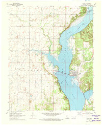
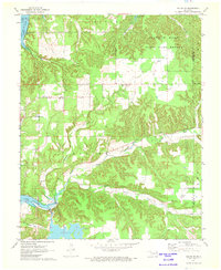
Other maps of this area

1896 · Pryor
USGS Topo · 1:125,000

1901 · Pryor
USGS Topo · 1:125,000

1954 · Tulsa
USGS Topo · 1:250,000

1958 · Tulsa
USGS Topo · 1:250,000

1963 · Tulsa
USGS Topo · 1:250,000
1970 · Chouteau
USGS Topo · 1:24,000
1970 · Rocky Point
USGS Topo · 1:24,000
1970 · Pryor
USGS Topo · 1:24,000
1971 · Salina
USGS Topo · 1:24,000
1971 · Salina SE
USGS Topo · 1:24,000