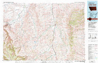
1980 Map of Lodge Grass
USGS Topo · Published 1981About this map
The Crow Indian Reservation occupies much of this 1980 landscape, where the high ridges of the Bighorn Mountains and Wolf Mountains frame a network of fertile creek valleys. The drainage patterns of the Little Bighorn River and Rotten Grass Creek dictate the placement of local infrastructure, particularly along the eastern corridor. Here, the Burlington Northern railroad and modern highways parallel the river, connecting small settlements such as Lodge Grass, Wyola, and Benteen.
Find a feature on this map
35 named features on this map. Tap any name to fly to it.
Don’t see what you’re looking for? This feature index may not catch every label — zoom into the map to look around manually.
Map Details
Editions of this 1980 Lodge Grass Map
2 editions found
Other maps of this area

1893 · Huntley
USGS Topo · 1:125,000

1894 · Rosebud
USGS Topo · 1:125,000

1894 · St. Xavier
USGS Topo · 1:125,000

1894 · Fort Custer
USGS Topo · 1:125,000

1895 · Dayton
USGS Topo · 1:125,000

1898 · Bald Mountain
USGS Topo · 1:125,000

1901 · Rosebud
USGS Topo · 1:125,000

1901 · Dayton
USGS Topo · 1:125,000

1901 · St. Xavier
USGS Topo · 1:125,000

1901 · Bald Mountain
USGS Topo · 1:125,000