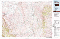
1980 Map of Lodge Grass
USGS Topo · Published 1987About this map
The Crow Indian Reservation dominates the landscape of this 1980 survey, covering a vast expanse of Big Horn County where the plains meet the rising ridges of the Wolf Mountains. The Little Bighorn River corridor serves as the primary artery for settlement and transport, with the Burlington Northern railroad tracking the valley floor through Lodge Grass, Wyola, and Spear. This infrastructure illustrates the late 20th-century reliance on rail for the movement of regional goods through the Montana-Wyoming borderlands.
Find a feature on this map
71 named features on this map. Tap any name to fly to it.
Don’t see what you’re looking for? This feature index may not catch every label — zoom into the map to look around manually.
Map Details
Editions of this 1980 Lodge Grass Map
2 editions found
Other maps of this area

1893 · Huntley
USGS Topo · 1:125,000

1894 · Rosebud
USGS Topo · 1:125,000

1894 · St. Xavier
USGS Topo · 1:125,000

1894 · Fort Custer
USGS Topo · 1:125,000

1895 · Dayton
USGS Topo · 1:125,000

1898 · Bald Mountain
USGS Topo · 1:125,000

1901 · Rosebud
USGS Topo · 1:125,000

1901 · Dayton
USGS Topo · 1:125,000

1901 · St. Xavier
USGS Topo · 1:125,000

1901 · Bald Mountain
USGS Topo · 1:125,000