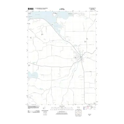
2010 Map of Lodi
USGS Topo · Published 2010About this map
The Merrimac Ferry provides a historic crossing of Lake Wisconsin at the northwestern edge of this landscape, connecting the road network near Merrimac to the shores of Okee and Harmony Grove. The terrain is defined by prominent elevations such as Gibraltar Rock and Goose Egg Hill, while the lower lands are drained by the winding course of Spring Creek as it passes through the heart of Lodi. This 2010 survey illustrates a mix of established residential pockets and agricultural expanses, punctuated by several historical burial grounds including Saint Patricks Cemetery and Mount Pleasant Cemetery. Transportation remains central to the area's layout, seen in the proximity of Lodi Lakeland Airport and the smaller Gannons Landing Strip to the west near Crystal Lake.
Find a feature on this map
59 named features on this map. Tap any name to fly to it.
Don’t see what you’re looking for? This feature index may not catch every label — zoom into the map to look around manually.
Map Details
Editions of this 2010 Lodi Map
This is the sole edition of this map. No revisions or reprints were ever made.
Other maps of this area

1890 · Madison
USGS Topo · 1:62,500

1892 · Madison
USGS Topo · 1:62,500

1895 · Baraboo
USGS Topo · 1:62,500

1901 · Poynette
USGS Topo · 1:62,500

1904 · Madison
USGS Topo · 1:62,500

1906 · Madison
USGS Topo · 1:62,500

1907 · Cross Plains
USGS Topo · 1:62,500

1908 · Baraboo
USGS Topo · 1:62,500

1909 · Cross Plains
USGS Topo · 1:62,500

1957 · Madison
USGS Topo · 1:250,000