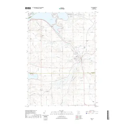
2018 Map of Lodi
USGS Topo · Published 2018About this map
Lodi serves as the central hub of this South Central Wisconsin landscape, where the waters of Spring Creek wind through the town toward the expansive Lake Wisconsin. The shoreline is punctuated by the residential clusters of Harmony Grove and Okee, while the prominent elevation of Gibraltar Rock overlooks the valley from the west. This 2018 survey detail shows a region shaped by both recreational lakeside development and long-standing agricultural roots, evidenced by the numerous small burial grounds such as Garden Bluff Cem and Saint Patricks Cem.
Find a feature on this map
90 named features on this map. Tap any name to fly to it.
Don’t see what you’re looking for? This feature index may not catch every label — zoom into the map to look around manually.
Map Details
Editions of this 2018 Lodi Map
This is the sole edition of this map. No revisions or reprints were ever made.
Other maps of this area

1890 · Madison
USGS Topo · 1:62,500

1892 · Madison
USGS Topo · 1:62,500

1895 · Baraboo
USGS Topo · 1:62,500

1901 · Poynette
USGS Topo · 1:62,500

1904 · Madison
USGS Topo · 1:62,500

1906 · Madison
USGS Topo · 1:62,500

1907 · Cross Plains
USGS Topo · 1:62,500

1908 · Baraboo
USGS Topo · 1:62,500

1909 · Cross Plains
USGS Topo · 1:62,500

1957 · Madison
USGS Topo · 1:250,000