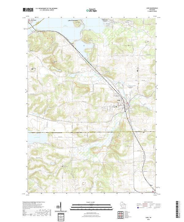
2022 Map of Lodi
USGS Topo · Published 2022About this map
Gibraltar Rock rises prominently above the surrounding landscape where the Sauk Co Columbia Co line meets the southern shores of Lake Wisconsin. This modern survey illustrates a diverse geography of water and wetlands, from the winding path of Spring Creek to the protected expanse of the Lodi Marsh. The settlement of Lodi serves as a central hub, connected by the Wisconsin & Southern RR and the winding Ice Age National Scenic Trl, which traverses the eastern hills. Local history is anchored by several burial grounds, including Garden Bluff Cem near Okee and Saint Patrick's Cem to the north. Smaller water bodies like Crystal Lake and Lantz Pond dot the southwestern reaches, while the Lodi Lakeland Airport marks the contemporary infrastructure of this rural community on the edge of the Columbia Co Dane Co border.
Find a feature on this map
96 named features on this map. Tap any name to fly to it.
Don’t see what you’re looking for? This feature index may not catch every label — zoom into the map to look around manually.
Map Details
Editions of this 2022 Lodi Map
This is the sole edition of this map. No revisions or reprints were ever made.
Other maps of this area

1890 · Madison
USGS Topo · 1:62,500

1892 · Madison
USGS Topo · 1:62,500

1895 · Baraboo
USGS Topo · 1:62,500

1901 · Poynette
USGS Topo · 1:62,500

1904 · Madison
USGS Topo · 1:62,500

1906 · Madison
USGS Topo · 1:62,500

1907 · Cross Plains
USGS Topo · 1:62,500

1908 · Baraboo
USGS Topo · 1:62,500

1909 · Cross Plains
USGS Topo · 1:62,500

1957 · Madison
USGS Topo · 1:250,000