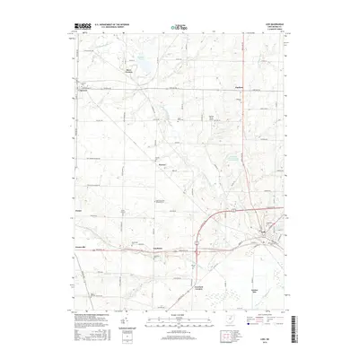
2016 Map of Lodi
USGS Topo · Published 2016About this map
Lodi serves as the primary hub in this southwestern Medina County landscape, where the confluence of several regional roads meets the E Fork Black River. The area maintains a high density of rural burial grounds, such as Woodlawn Cem, Old Lodi Cem, and the East Homerville Reformed Cem, providing a detailed record for genealogical research across the townships. Smaller hamlets like Homerville, Spencer, and Chatham anchor the surrounding agricultural grid, connected by historical routes including Greenwich Rd and Lafayette Rd. North of the town centers, Spencer Lake and the East Branch Black River define the local hydrography. The presence of Soaring Horse Airport and the Sherwood Forrest Camp Grounds Pond reflects the modern recreational use of this land, while scattered settlements like Pawnee and Esselburn preserve the names of earlier community centers.
Find a feature on this map
79 named features on this map. Tap any name to fly to it.
Don’t see what you’re looking for? This feature index may not catch every label — zoom into the map to look around manually.
Map Details
Editions of this 2016 Lodi Map
This is the sole edition of this map. No revisions or reprints were ever made.
Other maps of this area

1901 · Wooster
USGS Topo · 1:62,500

1903 · Wooster
USGS Topo · 1:62,500

1904 · Medina
USGS Topo · 1:62,500

1904 · Wellington
USGS Topo · 1:62,500

1906 · Medina
USGS Topo · 1:62,500

1906 · Wellington
USGS Topo · 1:62,500

1906 · West Salem
USGS Topo · 1:62,500

1908 · West Salem
USGS Topo · 1:62,500

1950 · Cleveland
USGS Topo · 1:250,000

1950 · Marion
USGS Topo · 1:250,000