
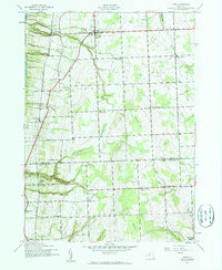
1942 Map of Lodi
USGS Topo · Published 1960About this map
The eastern shores of Seneca Lake define the western edge of this 1942 survey, where the steep glacial slopes rise toward the high agricultural plateaus of Lodi and Hector. The Lehigh Valley railroad cuts a diagonal path across the landscape, serving as a vital artery for local industry with stops at Lodi Station and the lakeside village of Caywood. This era of the Finger Lakes region is characterized by a dense network of one-room schoolhouses, including School No 11, School No 7, and the uniquely named Round Sch, reflecting the localized nature of rural education before modern district consolidation.
Find a feature on this map
33 named features on this map. Tap any name to fly to it.
Don’t see what you’re looking for? This feature index may not catch every label — zoom into the map to look around manually.
Map Details
Editions of this 1942 Lodi Map
2 editions found
Other maps of this area

1893 · Ithaca
USGS Topo · 1:62,500

1895 · Ithaca
USGS Topo · 1:62,500

1898 · Watkins Glen
USGS Topo · 1:62,500

1901 · Watkins
USGS Topo · 1:62,500

1902 · Genoa
USGS Topo · 1:62,500

1902 · Ovid
USGS Topo · 1:62,500

1905 · Watkins Glen
USGS Topo · 1:125,000

1942 · Ovid
USGS Topo · 1:31,680

1942 · Dundee
USGS Topo · 1:24,000

1942 · Sheldrake
USGS Topo · 1:24,000