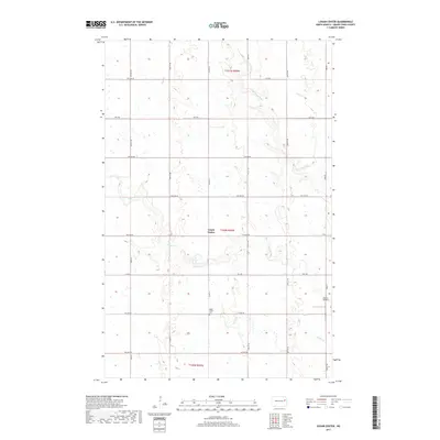
2017 Map of Logan Center
USGS Topo · Published 2017About this map
Logan Center and its surrounding rural landscapes characterize this 2017 survey of Grand Forks County. The terrain is defined by the winding paths of the Goose River and Little Goose River, which carve through the agricultural grid in the northern and central sections of the quadrangle. In the southern reach, Spring Cr flows through the prairie, marking the drainage pattern of the region. Local history and genealogy are anchored at the Logan Center Cem, located just south of the main settlement area near Co Rd 16. The presence of the Morten Airport on the eastern edge provides a contemporary landmark within a landscape otherwise dominated by a network of sectional roads such as 48th St NE and 13th Ave NE. The map illustrates the persistent structure of North Dakota's rural townships, where the intersection of watercourses and township lines dictates the placement of community infrastructure.
Find a feature on this map
28 named features on this map. Tap any name to fly to it.
Don’t see what you’re looking for? This feature index may not catch every label — zoom into the map to look around manually.
Map Details
Editions of this 2017 Logan Center Map
This is the sole edition of this map. No revisions or reprints were ever made.
Other maps of this area

1936 · Larimore
USGS Topo · 1:62,500

1939 · Niagara
USGS Topo · 1:62,500

1952 · Grand Forks
USGS Topo · 1:250,000

1956 · Grand Forks
USGS Topo · 1:250,000

1963 · Niagara SW
USGS Topo · 1:24,000

1963 · Larimore SW
USGS Topo · 1:24,000

1963 · Larimore West
USGS Topo · 1:24,000
1963 · Niagara
USGS Topo · 1:24,000

1963 · Logan Center
USGS Topo · 1:24,000

1966 · Grand Forks
USGS Topo · 1:250,000