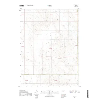
2017 Map of Logan
USGS Topo · Published 2017About this map
Logan serves as the primary focal point of this rural Nebraska survey, situated near the confluence of the S Loup River and its surrounding drainage systems. The landscape is defined by the winding course of Sand Cr and the prominent elevation of Kings Hill, which stands out against the agricultural and pastoral divisions of the region. Transportation patterns are dictated by a grid of rural routes including Milldale Rd and Co Line Rd, which bridge the boundaries of Logan, Custer, and Lincoln counties. The map provides a clear look at the intersection of local infrastructure and natural waterways in this section of the Great Plains, where family-named roads like Witthuhn Rd and Kramer Rd highlight the enduring legacy of local landholders and historical farmsteads.
Find a feature on this map
22 named features on this map. Tap any name to fly to it.
Don’t see what you’re looking for? This feature index may not catch every label — zoom into the map to look around manually.
Map Details
Editions of this 2017 Logan Map
This is the sole edition of this map. No revisions or reprints were ever made.
Other maps of this area

1948 · Linscott
USGS Topo · 1:62,500

1950 · Linscott
USGS Topo · 1:62,500

1951 · Hoagland
USGS Topo · 1:62,500

1954 · North Platte
USGS Topo · 1:250,000

1956 · North Platte
USGS Topo · 1:250,000

1957 · North Platte
USGS Topo · 1:250,000

1967 · North Platte
USGS Topo · 1:250,000

1972 · Logan
USGS Topo · 1:24,000

1972 · Arnold
USGS Topo · 1:24,000
1972 · Gandy
USGS Topo · 1:24,000