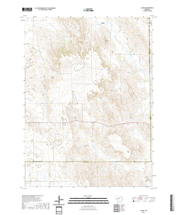
2021 Map of Logan
USGS Topo · Published 2021About this map
Logan sits along the northern edge of this Nebraska landscape, where the S Loup River winds through a terrain defined by high ridges and drainage basins. The map captures a largely rural section of the central plains, characterized by an organized grid of section lines and gravel routes such as Milldale Rd and River Rd. The topography is shaped by the elevation of Kings Hill and the seasonal flow of Sand Cr, which cuts across the central townships. This 2021 survey by the U.S. Geological Survey documents the modern boundaries between Logan, Custer, and Lincoln counties, providing a precise view of the ranching and agricultural road network, including family-named paths like Witthuhn Rd and Kramer Rd.
Find a feature on this map
22 named features on this map. Tap any name to fly to it.
Don’t see what you’re looking for? This feature index may not catch every label — zoom into the map to look around manually.
Map Details
Editions of this 2021 Logan Map
This is the sole edition of this map. No revisions or reprints were ever made.
Other maps of this area

1948 · Linscott
USGS Topo · 1:62,500

1950 · Linscott
USGS Topo · 1:62,500

1951 · Hoagland
USGS Topo · 1:62,500

1954 · North Platte
USGS Topo · 1:250,000

1956 · North Platte
USGS Topo · 1:250,000

1957 · North Platte
USGS Topo · 1:250,000

1967 · North Platte
USGS Topo · 1:250,000

1972 · Logan
USGS Topo · 1:24,000

1972 · Arnold
USGS Topo · 1:24,000
1972 · Gandy
USGS Topo · 1:24,000