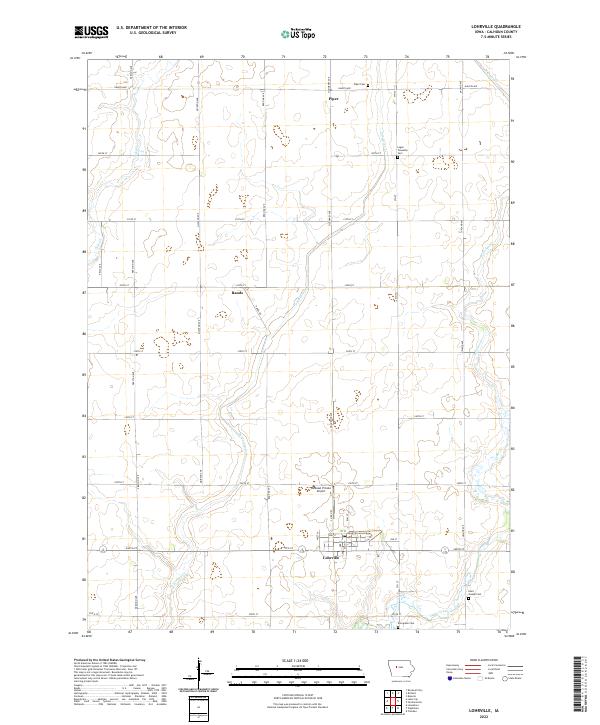
2022 Map of Lohrville
USGS Topo · Published 2022About this map
Lohrville sits at the heart of this Calhoun County agricultural landscape, where the town’s grid is anchored by Main St and Ralph Earwood Memo. The surrounding terrain is defined by the winding course of Purgatory Cr, which meanders through the township sections toward the southwest. Smaller hamlets and loading points like Piper and Rands are spaced along the section-line roads, illustrating the systematic rural development of the Iowa prairie. Several burial grounds serve as essential markers for local genealogy, including Piper Cem in the north and Evergreen Cem near the southern boundary. To the west of the main settlement, the Riedesel Private Airport provides a distinct modern landmark among the traditional farmstead plots and drainage networks of Cedar Creek.
Find a feature on this map
43 named features on this map. Tap any name to fly to it.
Don’t see what you’re looking for? This feature index may not catch every label — zoom into the map to look around manually.
Map Details
Editions of this 2022 Lohrville Map
This is the sole edition of this map. No revisions or reprints were ever made.
Other maps of this area

1954 · Fort Dodge
USGS Topo · 1:250,000

1957 · Fort Dodge
USGS Topo · 1:250,000

1958 · Fort Dodge
USGS Topo · 1:250,000

1962 · Jefferson
USGS Topo · 1:62,500

1965 · Farnhamville
USGS Topo · 1:24,000

1965 · Knierim
USGS Topo · 1:24,000

1980 · Rockwell City
USGS Topo · 1:24,000

1980 · Wightman
USGS Topo · 1:24,000
1980 · Lanesboro
USGS Topo · 1:24,000
1980 · Richard
USGS Topo · 1:24,000