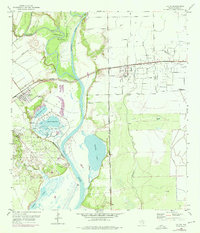
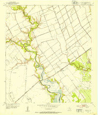
1952 Map of Lolita
USGS Topo · Published 1976About this map
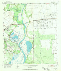
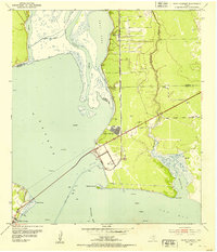
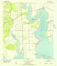
The confluence of the Lavaca River and the Navidad River dominates this coastal Texas landscape, where the seasonal movement of water across Lee Flat and through the Redfish Lake basin defines the local geography. Significant industrial development is evident near Vanderbilt and Lolita, including an Oil Refinery and an extensive Oil Field that speak to the region's mid-century petroleum economy. The Missouri Pacific railroad cuts a straight line across the wetlands, providing a critical transport link through the marshy terrain. Local landmarks such as Buzzard Roost Bend and Old Red Bluff reflect the traditional nomenclature of the river bends, while the presence of the Lolita Cem and scattered Windmill sites offer points of interest for genealogists tracing early family homesteads near the Lakes and Venado Creek.
Find a feature on this map
29 named features on this map. Tap any name to fly to it.
Don’t see what you’re looking for? This feature index may not catch every label — zoom into the map to look around manually.
Map Details
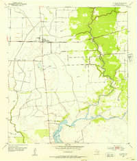
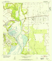
Editions of this 1952 Lolita Map
3 editions found
Other maps of this area
1952 · Francitas NW
USGS Topo · 1:24,000
1952 · Manson
USGS Topo · 1:24,000
1952 · Point Comfort
USGS Topo · 1:24,000
1952 · Olivia
USGS Topo · 1:24,000
1952 · Edna
USGS Topo · 1:24,000
1952 · Kamey
USGS Topo · 1:24,000
1952 · La Salle
USGS Topo · 1:24,000
1952 · La Ward
USGS Topo · 1:24,000
1952 · Lolita
USGS Topo · 1:24,000

1953 · Beeville
USGS Topo · 1:250,000