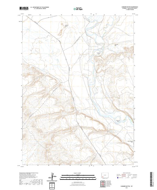
2021 Map of Lombard Buttes
USGS Topo · Published 2021About this map
Lombard Buttes stands as a prominent landmark in this portion of the Green River Basin, where historic western migration routes intersect the modern landscape. The path of the Brigham Young 1847 route and the Emigrant Trl wind through the arid terrain, marking the enduring significance of this corridor for transcontinental travel. The Green River meanders through the eastern half of the map, joined by the Big Sandy River and creating distinctive riverine features such as Freezeout Island and Telephone Island. This intersection of major waterways and historical trails illustrates the region's importance as both a navigational barrier and a vital resource for travelers. Contemporary access is maintained via La Barge Rd and the Access Road to Seedskadee Refuge, which cut across the high desert washes of Eightmile Wash and West Otterson Wash.
Find a feature on this map
17 named features on this map. Tap any name to fly to it.
Don’t see what you’re looking for? This feature index may not catch every label — zoom into the map to look around manually.
Map Details
Editions of this 2021 Lombard Buttes Map
This is the sole edition of this map. No revisions or reprints were ever made.
Other maps of this area

1954 · Rock Springs
USGS Topo · 1:250,000

1958 · Rock Springs
USGS Topo · 1:250,000

1961 · Blue Point
USGS Topo · 1:24,000

1961 · Sevenmile Gulch
USGS Topo · 1:24,000

1961 · Stevens Flat
USGS Topo · 1:24,000

1962 · Rock Springs
USGS Topo · 1:250,000

1963 · Gasson Bridge
USGS Topo · 1:24,000

1963 · Big Island Bridge
USGS Topo · 1:24,000
1963 · Whiskey Buttes
USGS Topo · 1:24,000
1963 · Mc Cullen Bluff
USGS Topo · 1:24,000