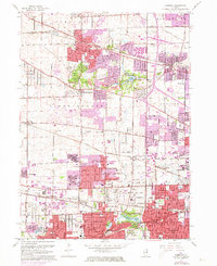
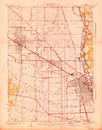
1962 Map of Lombard
USGS Topo · Published 1973About this map
The East Branch Du Page River winds through this region of DuPage County, illustrating a landscape in rapid transition as suburban development expands into agricultural land. Several historic rail lines, including the Chicago Milwaukee St Paul and Pacific and the Chicago and North Western, bisect the territory, connecting established centers like Roselle and Itasca with emerging communities. Modern infrastructure is visible through numerous Radio Towers (WBBM) and Radio Towers (WMAQ) dotting the landscape, while the presence of the U S Military Reservation near Addison reflects the era's Cold War defense posture. This survey serves as a detailed record of the area's mid-century evolution, preserved before the later infill of the Chicago metropolitan fringe.
Find a feature on this map
93 named features on this map. Tap any name to fly to it.
Don’t see what you’re looking for? This feature index may not catch every label — zoom into the map to look around manually.
Map Details
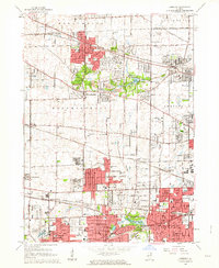
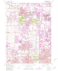
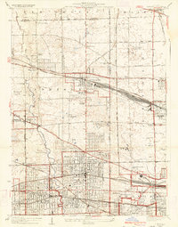
Editions of this 1962 Lombard Map
3 editions found
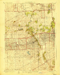
Other maps of this area

1891 · Riverside
USGS Topo · 1:62,500

1893 · Riverside
USGS Topo · 1:62,500

1900 · Riverside
USGS Topo · 1:62,500

1900 · Highwood
USGS Topo · 1:62,500

1901 · Riverside
USGS Topo · 1:62,500

1908 · Wheaton
USGS Topo · 1:62,500

1923 · Barrington
USGS Topo · 1:62,500
1927 · Hinsdale
USGS Topo · 1:24,000
1927 · Arlington Heights
USGS Topo · 1:24,000
1928 · Elmhurst
USGS Topo · 1:24,000