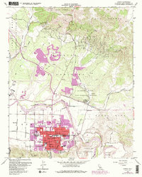
1959 Map of Lompoc
USGS Topo · Published 1986About this map
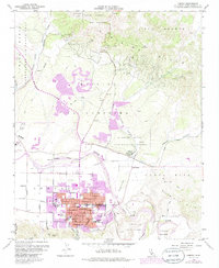
The La Purisima Mission State Historical Monument and its original Mission La Purisima Concepción serve as a cultural anchor north of the Santa Ynez River. This era of development shows the city of Lompoc expanding significantly, with residential growth reflected in the numerous street labels like Ocean Ave and H St. The local economy is a blend of agriculture, oil exploration in the Purisima Hills, and the logistical influence of Vandenberg Air Force Base on the western edge. Education and community life are well-documented through sites such as Lompoc High Sch, Hapgood Sch, and Ryon Memorial Park. Transportation infrastructure is dominated by the Southern Pacific railroad and its industrial spurs like White Hills Siding, alongside the Lompoc Airport and the coastal Pacific Coast Highway.
Find a feature on this map
58 named features on this map. Tap any name to fly to it.
Don’t see what you’re looking for? This feature index may not catch every label — zoom into the map to look around manually.
Map Details
Editions of this 1959 Lompoc Map
6 editions found
Other maps of this area

1905 · Guadalupe
USGS Topo · 1:125,000

1905 · Lompoc
USGS Topo · 1:125,000

1942 · Point Arguello
USGS Topo · 1:62,500

1942 · Guadalupe
USGS Topo · 1:125,000

1942 · Lompoc
USGS Topo · 1:125,000

1942 · Lompoc
USGS Topo · 1:62,500

1942 · Santa Maria
USGS Topo · 1:62,500

1942 · Point Sal
USGS Topo · 1:62,500

1943 · Lompoc
USGS Topo · 1:125,000

1947 · Lompoc
USGS Topo · 1:24,000