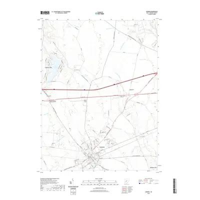
2019 Map of London
USGS Topo · Published 2019About this map
London serves as the focal point of this Madison County landscape, situated at the intersection of several key transit corridors including the National Pike and Old US Hwy 42 SE. The town's historic core is anchored by the Madison County Courthouse, with established residential blocks giving way to significant local landmarks such as Oak Hill Cem and the Madison County Airport. To the northwest, the residential development surrounding Lake Choctaw and the community of Choctaw Lake represents a shift toward modern lakeside living compared to the traditional agricultural patterns seen elsewhere.
Find a feature on this map
104 named features on this map. Tap any name to fly to it.
Don’t see what you’re looking for? This feature index may not catch every label — zoom into the map to look around manually.
Map Details
Editions of this 2019 London Map
This is the sole edition of this map. No revisions or reprints were ever made.
Other maps of this area

1907 · London
USGS Topo · 1:62,500

1907 · South Charleston
USGS Topo · 1:62,500

1914 · Mechanicsburg
USGS Topo · 1:62,500

1916 · Mechanicsburg
USGS Topo · 1:62,500

1916 · Milford Center
USGS Topo · 1:62,500

1944 · Mechanicsburg
USGS Topo · 1:62,500

1944 · Milford Center
USGS Topo · 1:62,500

1947 · Columbus
USGS Topo · 1:250,000

1950 · Marion
USGS Topo · 1:250,000

1961 · Columbus
USGS Topo · 1:250,000