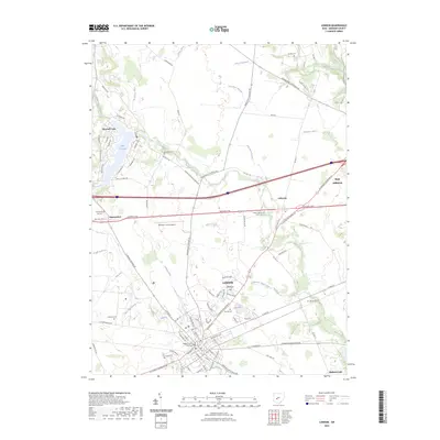
2023 Map of London
USGS Topo · Published 2023About this map
London serves as the focal point of this Madison County survey, with the Madison County Courthouse anchoring the town center. The landscape is defined by an intricate network of drainage systems, including Clingan Ditch, Roberts Ditch, and Chenoweth Ditch, which support the surrounding agricultural lands. To the west, the residential community around Lake Choctaw provides a contrast to the geometric agricultural plots that dominate the terrain. Historically significant burial sites are scattered throughout the quadrangle, from the Somerford Old Cem in the west to the Garrett Cem near West Jefferson. The National Pike and multiple county highways facilitate movement between established settlements like Lafayette and Summerford, while Oak Run and Deer Creek provide the primary natural waterways through this section of the Ohio till plain.
Find a feature on this map
104 named features on this map. Tap any name to fly to it.
Don’t see what you’re looking for? This feature index may not catch every label — zoom into the map to look around manually.
Map Details
Editions of this 2023 London Map
This is the sole edition of this map. No revisions or reprints were ever made.
Other maps of this area

1907 · London
USGS Topo · 1:62,500

1907 · South Charleston
USGS Topo · 1:62,500

1914 · Mechanicsburg
USGS Topo · 1:62,500

1916 · Mechanicsburg
USGS Topo · 1:62,500

1916 · Milford Center
USGS Topo · 1:62,500

1944 · Mechanicsburg
USGS Topo · 1:62,500

1944 · Milford Center
USGS Topo · 1:62,500

1947 · Columbus
USGS Topo · 1:250,000

1950 · Marion
USGS Topo · 1:250,000

1961 · Columbus
USGS Topo · 1:250,000