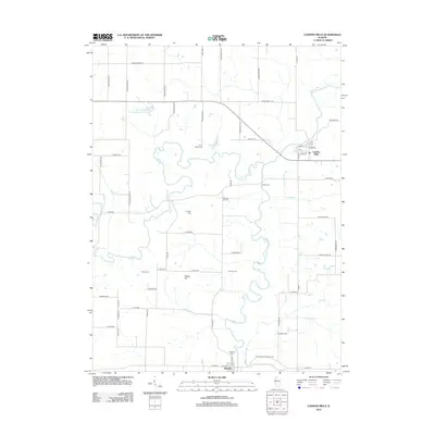
2012 Map of London Mills
USGS Topo · Published 2012About this map
Spoon River meanders south through this corner of Fulton County, connecting the riverfront village of London Mills with the southern settlement of Ellisville. This 2012 survey illustrates a landscape dominated by agriculture and waterway-adjacent recreation, featuring sites like Camp Wilderness and the Knox Company Conservation Club Lake. The mapping of several small family or community burial grounds, such as Landon Cem, Heartley Cem, and Flake Cem, provides essential points of reference for local genealogists tracing lineage along the river valley. Significant tributaries like Swegle Cr and Coal Cr carve through the terrain, while the name Indian Ford preserves the memory of an earlier river crossing point. The township road grid, including Knox Road 100 N, shows the persistent spatial organization of rural Illinois into the 21st century.
Find a feature on this map
67 named features on this map. Tap any name to fly to it.
Don’t see what you’re looking for? This feature index may not catch every label — zoom into the map to look around manually.
Map Details
Editions of this 2012 London Mills Map
This is the sole edition of this map. No revisions or reprints were ever made.
Other maps of this area

1912 · Canton
USGS Topo · 1:62,500

1915 · Avon
USGS Topo · 1:62,500

1925 · Galesburg
USGS Topo · 1:62,500

1927 · Galesburg
USGS Topo · 1:62,500

1941 · Maquon
USGS Topo · 1:62,500

1943 · Maquon
USGS Topo · 1:62,500

1944 · Avon
USGS Topo · 1:62,500

1958 · Burlington
USGS Topo · 1:250,000

1961 · Burlington
USGS Topo · 1:250,000

1963 · Burlington
USGS Topo · 1:250,000