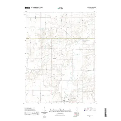
2021 Map of London Mills
USGS Topo · Published 2021About this map
The Spoon River meanders through the central Illinois landscape on this survey, anchoring the village of London Mills in the northeast and Ellisville to the south. The terrain is defined by a series of significant tributaries, including Cedar Creek, Swegle Cr, and Coal Cr, which carve through the surrounding uplands. For genealogists and local historians, the map is remarkably dense with burial grounds, marking the Ellisville Cem, Landon Cem, Flake Cem, Heartley Cem, and Pleasant Hill Cem. The boundary between Knox and Fulton counties bisects the region, running just south of Lake Roberts and the Knox Company Conservation Club Lake. Prominent elevations like Haney Hill overlook the floodplain, while an extensive network of rural roads, such as Co Rd 20 and E Coal Church Rd, connects the scattered farmsteads and agricultural holdings.
Find a feature on this map
48 named features on this map. Tap any name to fly to it.
Don’t see what you’re looking for? This feature index may not catch every label — zoom into the map to look around manually.
Map Details
Editions of this 2021 London Mills Map
This is the sole edition of this map. No revisions or reprints were ever made.
Other maps of this area

1912 · Canton
USGS Topo · 1:62,500

1915 · Avon
USGS Topo · 1:62,500

1925 · Galesburg
USGS Topo · 1:62,500

1927 · Galesburg
USGS Topo · 1:62,500

1941 · Maquon
USGS Topo · 1:62,500

1943 · Maquon
USGS Topo · 1:62,500

1944 · Avon
USGS Topo · 1:62,500

1958 · Burlington
USGS Topo · 1:250,000

1961 · Burlington
USGS Topo · 1:250,000

1963 · Burlington
USGS Topo · 1:250,000