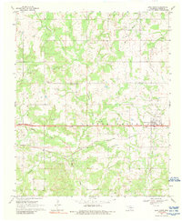
1969 Map of Lone Grove
USGS Topo · Published 1989About this map
The town of Lone Grove sits at the heart of this late-1960s landscape, positioned along the Atchison Topeka and Santa Fe railroad line. This era captures a region shaped by extractive industry and agriculture, most notably evidenced by the extensive Oil Field spanning the southwest quadrant. The terrain is deeply etched by a network of waterways including Cottonwood Creek, Walnut Bayou, and the uniquely named Demijohn Bayou, which flow through the Hewitt and Lone Grove districts.
Find a feature on this map
22 named features on this map. Tap any name to fly to it.
Don’t see what you’re looking for? This feature index may not catch every label — zoom into the map to look around manually.
Map Details
Editions of this 1969 Lone Grove Map
2 editions found
Other maps of this area

1901 · Ardmore
USGS Topo · 1:125,000

1918 · Ardmore
USGS Topo · 1:125,000

1957 · Ardmore
USGS Topo · 1:250,000

1963 · Ardmore
USGS Topo · 1:250,000

1964 · Ardmore West
USGS Topo · 1:24,000

1964 · Overbrook
USGS Topo · 1:24,000

1964 · Springer
USGS Topo · 1:24,000

1969 · Healdton
USGS Topo · 1:24,000

1969 · Lone Grove
USGS Topo · 1:24,000
1969 · Healdton SW
USGS Topo · 1:24,000