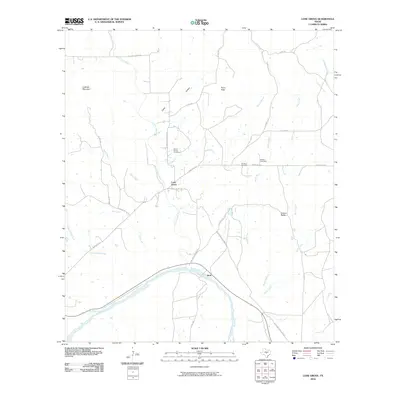
2010 Map of Lone Grove
USGS Topo · Published 2010About this map
The Little Llano River winds through this central Texas landscape, joining the larger Llano River near the small settlement of Stolz. This 2010 survey illustrates a region defined by its rugged topography and sparse ranching outposts, where prominent elevations like Lockhart Mountain and Point Peak overlook a network of seasonal creeks and draws. The settlement of Lone Grove sits at a crossroads north of the river, serving as a hub for the surrounding rural area.
Find a feature on this map
32 named features on this map. Tap any name to fly to it.
Don’t see what you’re looking for? This feature index may not catch every label — zoom into the map to look around manually.
Map Details
Editions of this 2010 Lone Grove Map
This is the sole edition of this map. No revisions or reprints were ever made.
Other maps of this area

1887 · Llano
USGS Topo · 1:125,000

1887 · Burnet
USGS Topo · 1:125,000

1893 · Burnet
USGS Topo · 1:125,000

1894 · Llano
USGS Topo · 1:125,000

1903 · Burnet
USGS Topo · 1:125,000

1904 · Llano
USGS Topo · 1:125,000

1909 · Llano
USGS Topo · 1:125,000

1909 · Burnet
USGS Topo · 1:125,000

1918 · Llano
USGS Topo · 1:125,000

1925 · Burnet 3-b
USGS Topo · 1:48,000