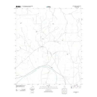
2012 Map of Lone Grove
USGS Topo · Published 2012About this map
Lone Grove serves as the central settlement in this portion of Llano County, situated where the Little Llano River flows toward its confluence with the larger Llano River to the south. The landscape is defined by its drainage systems and notable granite-country elevations, including Lockhart Mtn and Point Peak. This area retains a strong connection to its pioneer roots, evidenced by several family and community burial grounds such as Board Branch Cem, Flat Rock Cem, and Bluffton Cem. The road network, featuring Lone Grove Cutoff Rd and Old Kingsland-Llano Rd, suggests a long history of travel between these rural outposts and the larger county seats. Along the southern reach of the map, the hamlet of Stolz sits near the riverbanks, marking a landscape where water and rock outcrops like Cowen Rocks have dictated the patterns of ranching and settlement for generations.
Find a feature on this map
35 named features on this map. Tap any name to fly to it.
Don’t see what you’re looking for? This feature index may not catch every label — zoom into the map to look around manually.
Map Details
Editions of this 2012 Lone Grove Map
This is the sole edition of this map. No revisions or reprints were ever made.
Other maps of this area

1887 · Llano
USGS Topo · 1:125,000

1887 · Burnet
USGS Topo · 1:125,000

1893 · Burnet
USGS Topo · 1:125,000

1894 · Llano
USGS Topo · 1:125,000

1903 · Burnet
USGS Topo · 1:125,000

1904 · Llano
USGS Topo · 1:125,000

1909 · Llano
USGS Topo · 1:125,000

1909 · Burnet
USGS Topo · 1:125,000

1918 · Llano
USGS Topo · 1:125,000

1925 · Burnet 3-b
USGS Topo · 1:48,000