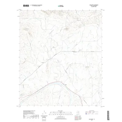
2019 Map of Lone Grove
USGS Topo · Published 2019About this map
The Llano River winds through this Central Texas landscape, marking the southern reach of a region defined by granite outcrops and rolling hills. Near the river's bend sits the settlement of Stolz, while the Little Llano River feeds in from the north, cutting through a series of significant elevations including Lockhart Mtn and Point Peak. The map reveals a deeply rooted rural community, preserved through numerous family and local burial grounds such as Board Branch Cem, Flat Rock Cem, and Bluffton Cem. Ancient road networks like the Old Kingsland-Llano Rd and Flat Rock Rd trace the historical movement of goods and people between these riverside outposts. Distinctive natural landmarks such as Cowen Rocks and the deep incision of Cedar Hollow provide clear orientation for those studying the physical geography of the Llano County backcountry.
Find a feature on this map
40 named features on this map. Tap any name to fly to it.
Don’t see what you’re looking for? This feature index may not catch every label — zoom into the map to look around manually.
Map Details
Editions of this 2019 Lone Grove Map
This is the sole edition of this map. No revisions or reprints were ever made.
Other maps of this area

1887 · Llano
USGS Topo · 1:125,000

1887 · Burnet
USGS Topo · 1:125,000

1893 · Burnet
USGS Topo · 1:125,000

1894 · Llano
USGS Topo · 1:125,000

1903 · Burnet
USGS Topo · 1:125,000

1904 · Llano
USGS Topo · 1:125,000

1909 · Llano
USGS Topo · 1:125,000

1909 · Burnet
USGS Topo · 1:125,000

1918 · Llano
USGS Topo · 1:125,000

1925 · Burnet 3-b
USGS Topo · 1:48,000