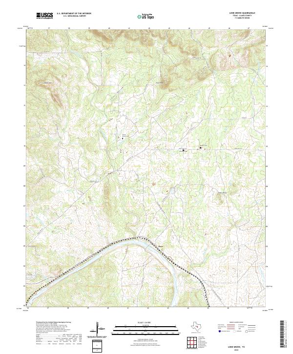
2022 Map of Lone Grove
USGS Topo · Published 2022About this map
Stolz sits at a bend of the Llano River in this Llano County landscape, where the river's path is joined by several tributaries including Mud Cr and Harris Br. The terrain north of the river is defined by prominent elevations such as Lockhart Mtn and Point Peak, with the Little Llano River cutting through the western portion of the quadrangle. Local history is preserved in several rural burial grounds, including Board Branch Cem, Flat Rock Cem, and Bluffton Cem, which serve as anchors for genealogical research in this part of the Texas Hill Country. Historical transport routes like the Old Kingsland-Llano Rd and Flat Rock Rd trace the movement of early residents between the rocky outcrops of Cowen Rocks and the river valley below.
Find a feature on this map
41 named features on this map. Tap any name to fly to it.
Don’t see what you’re looking for? This feature index may not catch every label — zoom into the map to look around manually.
Map Details
Editions of this 2022 Lone Grove Map
This is the sole edition of this map. No revisions or reprints were ever made.
Other maps of this area

1887 · Llano
USGS Topo · 1:125,000

1887 · Burnet
USGS Topo · 1:125,000

1893 · Burnet
USGS Topo · 1:125,000

1894 · Llano
USGS Topo · 1:125,000

1903 · Burnet
USGS Topo · 1:125,000

1904 · Llano
USGS Topo · 1:125,000

1909 · Llano
USGS Topo · 1:125,000

1909 · Burnet
USGS Topo · 1:125,000

1918 · Llano
USGS Topo · 1:125,000

1925 · Burnet 3-b
USGS Topo · 1:48,000