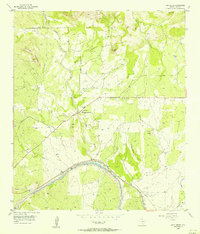
1956 Map of Lone Grove
USGS Topo · Published 1956About this map
The Little Llano River carves through the heart of Llano County in this mid-century survey, defining a landscape shaped by narrow creek valleys and granite outcrops. Small ranching-era settlements like Lone Grove and Stolz appear along the drainage of Miller Creek and Little Sandy Creek, while the presence of a Community Center and an Airstrip reflect the local infrastructure of the 1950s. The terrain is marked by distinctive elevations such as Lockhart Mountain and Point Peak, and several local cemeteries including Board Branch Cem and Bluffton Cem provide critical touchpoints for genealogical research. The map also captures the industrial activity of the period with a Rock Quarry and traces of the New Orleans And Texas Llano route, showing the region's connection to wider transportation networks.
Find a feature on this map
22 named features on this map. Tap any name to fly to it.
Don’t see what you’re looking for? This feature index may not catch every label — zoom into the map to look around manually.
Map Details
Editions of this 1956 Lone Grove Map
This is the sole edition of this map. No revisions or reprints were ever made.
Other maps of this area

1887 · Llano
USGS Topo · 1:125,000

1887 · Burnet
USGS Topo · 1:125,000

1893 · Burnet
USGS Topo · 1:125,000

1894 · Llano
USGS Topo · 1:125,000

1903 · Burnet
USGS Topo · 1:125,000

1904 · Llano
USGS Topo · 1:125,000

1909 · Llano
USGS Topo · 1:125,000

1909 · Burnet
USGS Topo · 1:125,000

1918 · Llano
USGS Topo · 1:125,000

1925 · Burnet 3-b
USGS Topo · 1:48,000