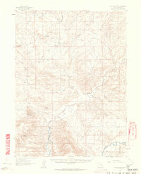
1960 Map of Lone Mountain
USGS Topo · Published 1963About this map
Ross Mountain and Peck Mesa rise above the high desert landscape of Moffat County, where the confluence of the Yampa River and the Little Snake River dictates the pattern of early ranching life. This 1960 field-checked survey highlights a remote network of family-held operations, from the Sheridan Ranch in the river bottom to the Solace Ranch tucked into the draws.
Find a feature on this map
36 named features on this map. Tap any name to fly to it.
Don’t see what you’re looking for? This feature index may not catch every label — zoom into the map to look around manually.
Map Details
Editions of this 1960 Lone Mountain Map

Other maps of this area

1907 · Rangely
USGS Topo · 1:125,000

1907 · White River
USGS Topo · 1:125,000

1910 · White River
USGS Topo · 1:125,000

1910 · Rangely
USGS Topo · 1:125,000

1954 · Vernal
USGS Topo · 1:250,000

1958 · Vernal
USGS Topo · 1:250,000

1958 · Maybell
USGS Topo · 1:62,500

1958 · Citadel Plateau
USGS Topo · 1:62,500

1960 · Vernal
USGS Topo · 1:250,000

1960 · Elk Springs
USGS Topo · 1:62,500