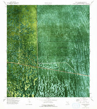
1973 Map of Lone Palm Head
USGS Topo · Published 1993About this map
The Florida State Miccosukee Indian Reservation dominates this 1970s orthophotomap, showing a landscape defined by water management and the natural patterns of the Everglades. The area is a complex of wetlands within the Everglades Wildlife Management Area, where the USGS identifies Conservation Area No 3A Water Impounded Periodically in this Area. Human engineering is visible through a network of infrastructure including Levee 67, Levee 28, and the Interceptor Canal.
Find a feature on this map
16 named features on this map. Tap any name to fly to it.
Don’t see what you’re looking for? This feature index may not catch every label — zoom into the map to look around manually.
Map Details
Editions of this 1973 Lone Palm Head Map
2 editions found
Other maps of this area

1956 · West Palm Beach
USGS Topo · 1:250,000

1957 · West Palm Beach
USGS Topo · 1:250,000

1958 · West Palm Beach
USGS Topo · 1:250,000

1973 · Everglades 4 NW
USGS Topo · 1:24,000
1973 · Everglades 4 SW
USGS Topo · 1:24,000

1973 · Everglades 3 NE
USGS Topo · 1:24,000

1974 · Everglades 1 SW
USGS Topo · 1:24,000

1974 · Everglades 2 SW
USGS Topo · 1:24,000

1974 · Everglades 2 SE
USGS Topo · 1:24,000
1974 · Everglades 3 SW
USGS Topo · 1:24,000