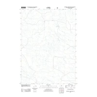
2012 Map of Lone Well Creek West
USGS Topo · Published 2012About this map
Lone Well Cr and N Black Banks Cr weave through this arid portion of Fall River County, marking a landscape defined by its seasonal drainage patterns and sparse infrastructure. The presence of CO Hwy-6 and CO Hwy-6f indicates the essential transportation corridors that connect this rural South Dakota terrain, providing the only primary access through the surrounding plains. These watercourses, including Tepee Cr and Beef Cr, suggest a cattle-ranching environment where natural water sources and intermittent streams dictate the movement of livestock and the placement of local roads. The map reveals the intricate network of coulees and draws that feed into these larger creek systems, characteristic of the northern Great Plains geography.
Find a feature on this map
7 named features on this map. Tap any name to fly to it.
Don’t see what you’re looking for? This feature index may not catch every label — zoom into the map to look around manually.
Map Details
Editions of this 2012 Lone Well Creek West Map
This is the sole edition of this map. No revisions or reprints were ever made.
Other maps of this area

1896 · Oelrichs
USGS Topo · 1:125,000

1900 · Oelrichs
USGS Topo · 1:125,000

1902 · Edgemont
USGS Topo · 1:125,000

1950 · Heppner
USGS Topo · 1:24,000

1950 · Cascade Springs
USGS Topo · 1:24,000

1950 · Hot Springs SE
USGS Topo · 1:24,000

1950 · Angostura Reservoir
USGS Topo · 1:24,000

1955 · Hot Springs
USGS Topo · 1:250,000
1982 · Black Banks Creek East
USGS Topo · 1:24,000
1982 · Black Banks Creek West
USGS Topo · 1:25,000