Loading...
Loading map...1906 Map of Lonesome
USGS Topo · Published 1946About this map
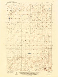
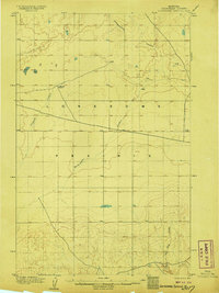
Lonesome Prairie stretches across this north-central Montana landscape, documented by topographer Wm. Stranahan just after the turn of the century. The terrain is defined by a series of deep drainage channels, including Sixmile Coulee, Twelvemile Coulee, and Fourteenmile Coulee, which carve through the high plains toward the southern reaches of the map. This era of settlement is sparsely represented, anchored primarily by Godfrey's Ranch, located near the center of the sheet.
Find a feature on this map
9 named features on this map. Tap any name to fly to it.
Don’t see what you’re looking for? This feature index may not catch every label — zoom into the map to look around manually.
Map Details
Date Portrayed1906
Date Published1946
PublisherU.S. Geological Survey
Map TypeTopographic
Scale1:62,500
Physical Dimensions15.2 x 20.2 inches
Editions of this 1906 Lonesome Map
2 editions found
Historical Maps of Kenilworth Through Time
Featured Locations
Source Details
SourceU.S. Geological Survey
CopyrightPublic Domain