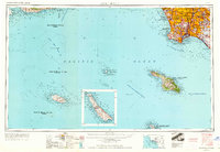
1957 Map of Long Beach
USGS Topo · Published 1964About this map
The Pacific Ocean dominates this late-1950s survey, illustrating the maritime and military significance of the Southern California coast. The mainland reveals the dense suburban expansion of the Los Angeles basin, including Culver City, Watts, and Compton, while the coastline is defined by the strategic presence of the Fort Mac Arthur Upper Reservation and Alamitos Naval Res. Much of the offshore area is designated as a Naval Air Missiles Test Area, underscoring the region's mid-century role in defense and aerospace testing.
Find a feature on this map
76 named features on this map. Tap any name to fly to it.
Don’t see what you’re looking for? This feature index may not catch every label — zoom into the map to look around manually.
Map Details
Editions of this 1957 Long Beach Map
4 editions found

Other maps of this area

1894 · Los Angeles
USGS Topo · 1:62,500

1894 · Pomona
USGS Topo · 1:62,500

1896 · Santa Ana
USGS Topo · 1:62,500

1896 · Pasadena
USGS Topo · 1:62,500

1896 · Anaheim
USGS Topo · 1:62,500

1896 · Redondo
USGS Topo · 1:62,500

1896 · Las Bolsas
USGS Topo · 1:62,500

1896 · Santa Monica
USGS Topo · 1:62,500

1896 · San Pedro
USGS Topo · 1:62,500

1896 · Downey
USGS Topo · 1:62,500