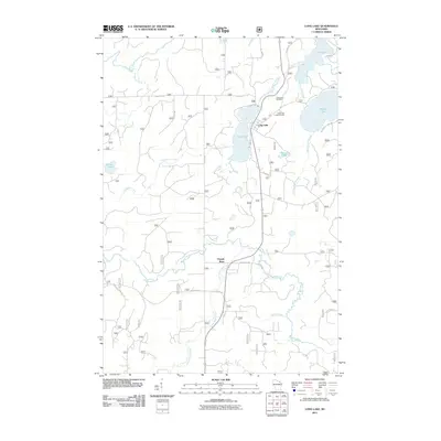
2011 Map of Long Lake
USGS Topo · Published 2011About this map
Long Lake and the adjacent settlement of Popple River anchor this northern Wisconsin landscape, defined by an intricate network of waterways and glacial depressions. The terrain is a mosaic of lakes and drainage channels, with Halsey Lake and Fay Lake feeding a system of outlets that eventually join the broader Pine River and Little Popple River watersheds. The concentration of water features like Halsey Lake Slough and Beaver Pond suggests a low-lying, poorly drained forest environment typical of Florence County.
Find a feature on this map
36 named features on this map. Tap any name to fly to it.
Don’t see what you’re looking for? This feature index may not catch every label — zoom into the map to look around manually.
Map Details
Editions of this 2011 Long Lake Map
This is the sole edition of this map. No revisions or reprints were ever made.
Other maps of this area

1938 · Alvin
USGS Topo · 1:48,000

1939 · Crandon
USGS Topo · 1:48,000

1939 · Laona
USGS Topo · 1:48,000

1939 · Long Lake
USGS Topo · 1:48,000

1941 · Crandon
USGS Topo · 1:48,000

1946 · Laona
USGS Topo · 1:48,000

1946 · Alvin
USGS Topo · 1:48,000

1947 · Crandon
USGS Topo · 1:48,000

1948 · Long Lake
USGS Topo · 1:48,000

1954 · Iron Mountain
USGS Topo · 1:250,000