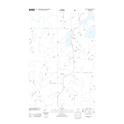
2013 Map of Long Lake
USGS Topo · Published 2013About this map
The settlement of Long Lake serves as a focal point for this section of Florence County, where the landscape is defined by an intricate network of glacial lakes and waterways. The Long Lake Outlet connects the namesake lake to Halsey Lake and Fay Lake to the northeast, while the Popple River and its tributary, the Little Popple River, dominate the southern half of the quadrangle. Transport in the early 21st century remains tied to the local timber and recreation economy, evidenced by the numerous National Forest roads like National Forest Road 2167 and MacArthur-Pine Rd. This area reflects the character of the Wisconsin Northwoods, where drainages like Coldwater Cr and Martin Cr thread through a region of managed forest lands and quiet water bodies such as Bastile Lake.
Find a feature on this map
36 named features on this map. Tap any name to fly to it.
Don’t see what you’re looking for? This feature index may not catch every label — zoom into the map to look around manually.
Map Details
Editions of this 2013 Long Lake Map
This is the sole edition of this map. No revisions or reprints were ever made.
Other maps of this area

1938 · Alvin
USGS Topo · 1:48,000

1939 · Crandon
USGS Topo · 1:48,000

1939 · Laona
USGS Topo · 1:48,000

1939 · Long Lake
USGS Topo · 1:48,000

1941 · Crandon
USGS Topo · 1:48,000

1946 · Laona
USGS Topo · 1:48,000

1946 · Alvin
USGS Topo · 1:48,000

1947 · Crandon
USGS Topo · 1:48,000

1948 · Long Lake
USGS Topo · 1:48,000

1954 · Iron Mountain
USGS Topo · 1:250,000