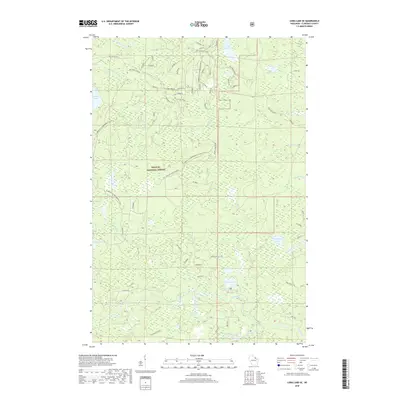
2018 Map of Long Lake SE
USGS Topo · Published 2018About this map
Nicolet National Forest encompasses this stretch of the Wisconsin Northwoods, where the landscape is defined by an intricate network of glacial lakes and river systems. The northern portion is marked by the Pine River and its connection to Halsey Lake via the Fay Lake Outlet. To the south, the Popple River and the South Branch Popple River carve through the timberland. A legacy of forest management and logging is evident in the naming of thoroughfares like Flume Road and Morgan Lake Spur Road, while more local lore persists in labels such as Dead Mans Road. The area remains an active recreational hub, crisscrossed by the Florence Co Snowmobile trails and various US Forest Service routes, serving remote waters like Lake Seventeen and Morgan Lake.
Find a feature on this map
63 named features on this map. Tap any name to fly to it.
Don’t see what you’re looking for? This feature index may not catch every label — zoom into the map to look around manually.
Map Details
Editions of this 2018 Long Lake SE Map
This is the sole edition of this map. No revisions or reprints were ever made.
Other maps of this area

1939 · Goodman
USGS Topo · 1:48,000

1939 · Laona
USGS Topo · 1:48,000

1939 · Long Lake
USGS Topo · 1:48,000

1941 · Florence
USGS Topo · 1:48,000

1946 · Laona
USGS Topo · 1:48,000

1946 · Goodman
USGS Topo · 1:48,000

1947 · Naults
USGS Topo · 1:24,000

1948 · Long Lake
USGS Topo · 1:48,000

1954 · Iron Mountain
USGS Topo · 1:250,000

1959 · Iron Mountain
USGS Topo · 1:250,000